
Sometimes the most useful response is simply doing what you do best.
Map House in Thamel, Kathmandu, has stepped up by quickly producing large, detailed maps of the districts affected by the floods and landslides. These are helping rescue and response teams identify villages, settlements and access routes across a very difficult landscape.
Map House is one of Nepal’s leading specialist map publishers, producing the detailed maps used by trekkers, guides and mountain professionals across Nepal. During this crisis, that same expertise is being put directly to work for the response.
The maps cover the affected river corridor and surrounding districts, helping teams understand the geography on the ground.
Understanding the affected area
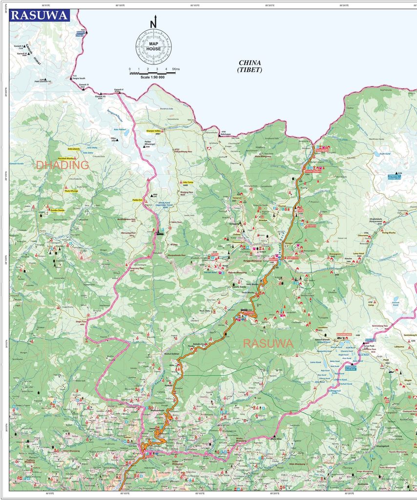
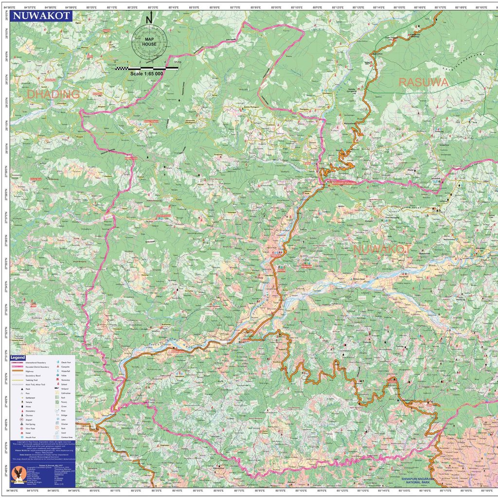
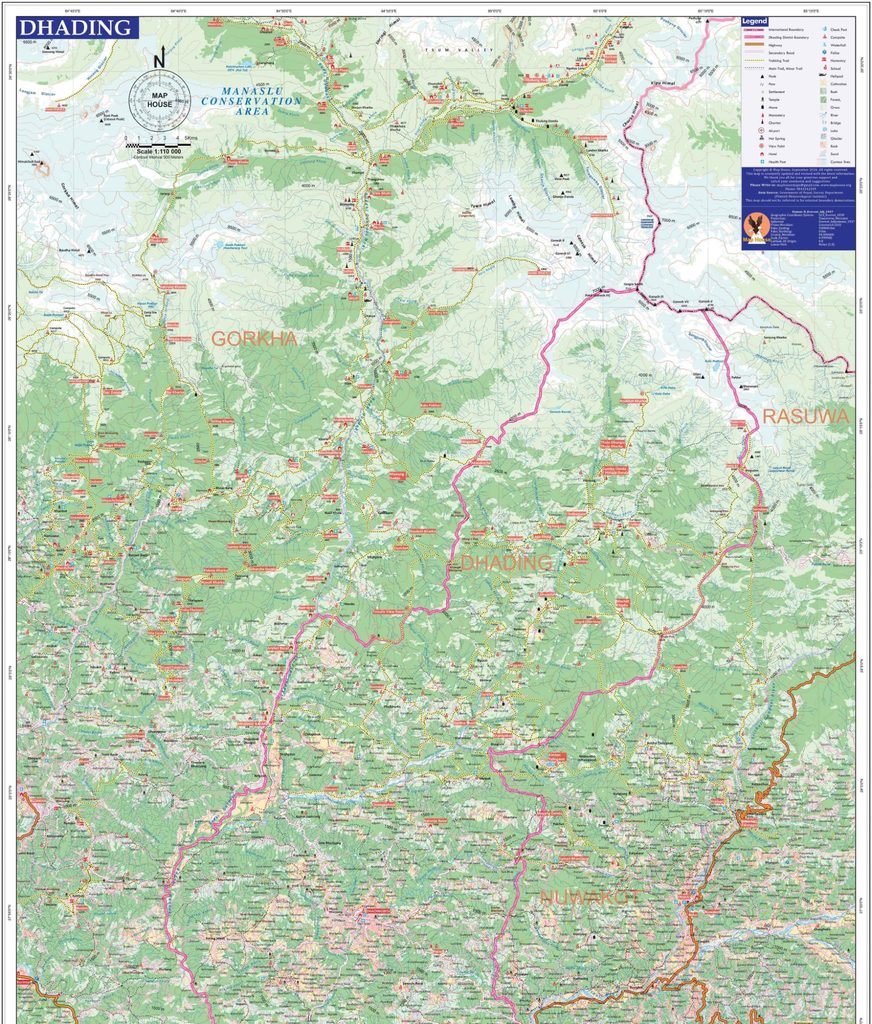
The disaster began in Rasuwa, along the Bhote Koshi–Upper Trishuli river system.
The flood then travelled downstream, affecting communities in Nuwakot and Dhading, before the river system continues towards Chitwan. By the time the flood reached much further downstream, the impact was considerably less.
This distinction is important.
This is a major disaster, but it is concentrated along one river corridor. It is not a disaster affecting all of Nepal.
Across the country, government agencies, security forces, communities, businesses and individuals are contributing whatever they can — logistics, helicopters, technology, communications, supplies, expertise and, in this case, maps.
Map House is a wonderful example of that response.
Use what you know. Use what you have. Help where you can.
Kudos to the team at Map House. You guys rock.
Nepal comes together. And Nepal will rebuild and recover.
The detailed Map House maps accompanying this resource can be used by response workers and others trying to understand the geography of the affected corridor.


